


The 700th anniversary of Vilnius is becoming the catalyst for many interesting projects that will be useful and exciting even after the year is over. One of those is a new website, www.vilniusdnr.lt – an archive of digitized topographical maps of the city and a wealth of information. Described as a portal to the history of Vilnius, it contains photographs, city plans as well as descriptions of historical figures and events. Together they form the “DNA code of the city” (DNR in Lithuanian). Created by the municipal government and the firm “Vilniaus planas”, it is a comprehensive source of information for both residents and visitors.
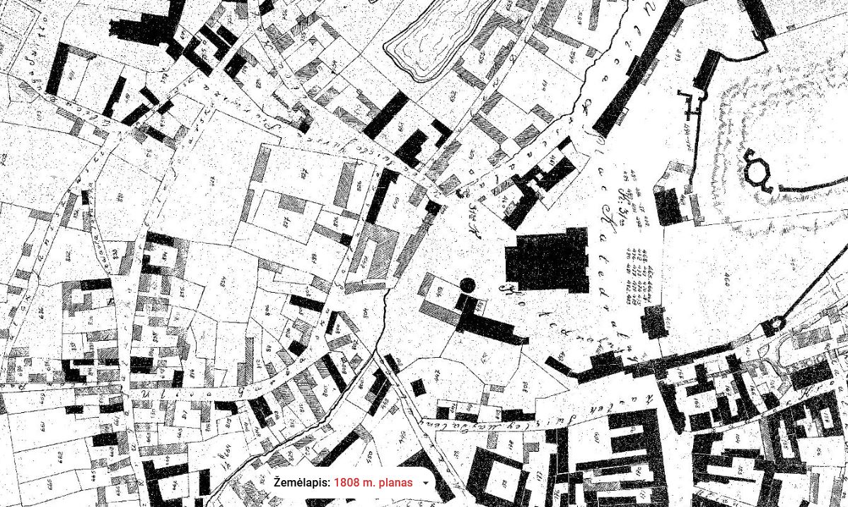
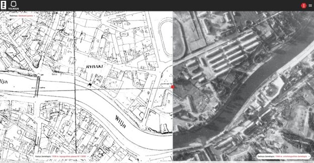 Cartographers at “Vilniaus planas” chose the best large scale maps from five time periods: 1808 – the pre-Czarist era, 1845 – the mid-Czarist era, 1938 the first independence period, and 1977 – the late Soviet era.
Archival research, analysis and transfer to a database took two years. Paper maps were digitized and updated to current coordinate standards. The portal is adapted for mobile devices and smart screens, and various objects are linked, so the user can arrange walking tours, for example. There is also an interactive function which connects various historical periods, showing changes in city streets and buildings.
 There are entries on about 712 historical figures, from the Grand Dukes to contemporary artists, scientists, and politicians and the places where they are memorialized, with plaques, monuments, sculptures and other artistic and architectural landmarks. The portal is already being used by experts preparing competitions for the maintenance and renovation of various areas in the city.
The portal is currently available only in Lithuanian but will be expanded in the near future to include other languages as well as a function allowing the public to submit their own historical photos and postcards.


